I love this video, if I ever got the "NFlightcam Plus" camera, I want to make my own version (but with a Cessna of course) with some of my favorite flights.
Saturday, February 25, 2012
Thursday, February 23, 2012
Why I Didn't Fly Today...
Here is why I didn't fly today, these are the METARs from KRYY (Cobb County, base airport) KRHP (solo cross-country airport,) and KAHN (secondary solo cross country airport):
KRYY
11AM - Winds 220 @ 11 Gusting up to 18
12PM - Winds 220 @ 12 Gusting up to 20 ... Winds vary between 170 and 250
1PM - Winds 200 @ 14 Gusting up to 22
2PM - Winds 220 @ 14 Gusting up to 24... Winds vary between 170 and 250
3PM - Winds 210 @ 14 Gusting up to 26... Winds vary between 170 and 250
4PM - Winds 210 @ 13 Gusting up to 25... Winds vary between 180 and 270
KRHP
11AM - Winds 240 @ 10 Gusting up to 15
12PM - Winds 220 @ 13 Gusitng up to 17
1PM - Winds 240 @ 15 Gusting up to 20
2PM - Winds 220 @ 10 Gusting up to 25
3PM - Winds 230 @ 17 Gusting up to 24
4PM - Winds 220 @ 12 Gusting up to 23
KAHN
11AM - Winds 240 @ 11 Gusting up to 21
12PM - Winds 240 @ 11 Gusting up to 17
1PM - Winds 230 @ 10 Gusting up to 24
2PM - Winds 220 @ 12 Gusting up to 26
3PM - Winds 210 @ 12 Gusting up to 26.
PIREP
PIREP 22:19Z 02/23/12
RYY UUA /OV KRYY/TM 2219/FL004/TP BE40/RM LLWS +20KT 400 AGL FAP RWY 27
So, never the less, it would've been a very bouncy day up there today. Tomorrow and Saturday looks like a no-go also due to winds and weather. Will keep ya posted. Hold on to your hats out there!
Possible Grounding?
Well, with this being a 3-day weekend (Thursday, Friday, and Saturday,) I was really hoping to get some flying in. I was hoping to finish up my long solo cross-country, and start preparing for my check-ride.
Right now, looking at the weather forecast for KRYY the next several days, looks like I’m ground on all three due to winds (and some weather):
Thursday – Fog before 7AM, cloudy otherwise then gradually becoming mostly sunny. Winds Southwest at 5-15 with gusts up to 20.
Friday – Chance of showers and storms before 1PM, then mostly cloudy. Winds West around 10 with gust 20.
Saturday – Sunny. Winds Northwest between 15-25 with gust as high as 35.
The thing that seems to be grounding me is the winds. Have student solo restrictions on me of Winds up to 10, and crosswinds of 7.
Also, for today (Thursday) when I would be doing my cross country solo work the winds at the levels I would be flying would be: 6,000 feet – 260 @ 38knots 9,000 feet – 260 @ 51knots
I’m still planning on going to the flight school at 10AM today and just seeing at that time what it looks like, but more than likely, no-go for this weekend at all.
As we all know with weather, it can change in a heartbeat.
Sunday, February 19, 2012
A Flight To The Mountains – 2/17/2012
Well, a couple of things have happened since my last post. On 2/16/2012 (Thursday) I went into the flight school to take a pre-test for the Written, and passed it. While talking to the dispatcher about it, and my high test anxiety, I decided to go ahead and take the test that day. At 12:05PM, the test begun. Now mind you, that I have one of the worst test anxieties out there. I've actually lost sleep over this test, I'm more of a projects person, hands on. Give me a project, or something that I can use my hands, and I'll pass it with flying colors. Well, as I mentioned, I did take the test, and PASSED! I didn't get the high score that I wanted, but the main thing is that I passed. I didn't pass on the low end of the scale, so that made it a tad bit better. I just wonder how the examiner will take it during the Oral part of the test. The main thing is, I PASSED! We'll cross the Oral part of the test when we get there, taking a small break this weekend from studying, but will continue to study, now for the oral, starting on Monday.
Thursday was a bad day to fly anyways, it was raining, and pretty heavy at times. So, it was a good day to take the test. On Friday, it was a different story...
Friday, was beautiful. Sunny and warm. It was the perfect definition of flying weather. Winds were out of the north at around 5 or so. And I had scheduled to go up at around 10AM to do a cross-country. Well, an unexpected appointment came up at 11:15AM, so I couldn't do my cross-country at 10AM, so I moved it to 12:30PM. As the Pilot-In-Charge, that was a great decision, the location I was going to, was socked in with fog. They were reporting Fog, with overcast clouds at 100 feet, and ground visibility at ¼ Statute miles. But as the morning went on, the fog started to burn off, and by the time I was getting ready for my flight, they were reporting winds at 230 @ 5, and clear skies! Off to the Mountains of North Carolina, Off to Western Carolina Regional (KRHP)!
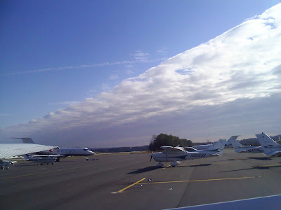
Took good ol' 653KB up to about 5,500 feet. Flew over Allatonna Lake, which was very blue. Flew just east of Canton, and right over Nelson, GA, heading for the mountains. As I started to get close and over the mountains, the turbulence started to pick up. I would say it was Light Chop with moments of moderate turbulence. This mainly happened over “Alert Area A-685,” which is a 25 mile military zone. The highest mountain in that area is 3,767 feet, so I still had plenty of room. Passed three miles west of Blairsville, and off my nose at 12 o'clock was KRHP. KRHP is in a valley between 3 mountains ranging in 5,000 feet range. The airport is located at 1,697 feet. So as you are going through the valley, there are 5,000 feet mountain ranges around you. The real butt clincher is when you are turning from base to final onto runway 26, all you see through your windscreen is mountain. You are very close to a mountain. Landed safely at KRHP, and decided to take a break... my bladder was full. So, while I was out, took a couple snapshots, which are below.
Headed back into KB, and taxied to the runway. Unfortunately, a majority of their taxiways are closed, so I had to announce, and made sure any incoming aircraft knew, that I was going to take to the runway, and taxi to the end of it, do a 180, and take off from there. I wasn't planning on doing a short-field take off, especially with those mountains around, I wasn't going to take a chance.
Took off from KRHP with no issue, and was heading for an altitude of 6,500 feet. While cursing at 6,000 still climbing, I had my left hand on the yoke, my paperwork and maps on my lap, and my right hand on the throttle, about to power down... when all of the sudden, I felt something on my left arm. Knowing that I'm at around 6,000 feet, and knew there shouldn't be anything on my arm, I looked down, and there was a big wasp on my arm. Not knowing if I'm allergic to bee/wasp stings, I decided to do what any pilot would do... fly the plane. In the mean time, I leveled off, took the map, and swatted him like a baseball! Luckily he didn't sting me, because if he did, I would of more than likely had to land at Blairsville (KDZJ) or fly an additional 25 miles before I got to Pickens (KJZR) for safety. I can just hear me talking to Atlanta Center, with all the professional airline pilots on the same frequency, and telling them my intentions due to a wasp sting... embarrassing! Main thing is, it didn't sting me.
Landed safely back at KRYY, and that ended my flying adventure for Friday!
On Tuesday, I'm planning to go up, and do some practice with Steep Turns and more landing practices. Steep turns make me nauseous, so I need to get my body use to it. You try and do a 360, at around 2500 feet while at a 45 degree bank and see what happens to you. On Thursday, I'm planning on doing my “Long Cross-country,” which will take me from KRYY to KRHP (Western Regional) to KJZR (Pickens) back to KRYY.
Enjoy the photos below... See ya in the skies!


Looking towards the South/Southesast.
Wednesday, February 15, 2012
To Athens, No, The Other One... - 2/15/2012
Headed Eastward today to Athens, GA (for the 3rd time.) My second solo cross-country trip. Is uneventful a good thing? Sometimes, but when you are piloting a plane, it definitely is!
Taking off from runway 9 at KRYY, we had a wind at 120 @ 5kts. Nothing major, really didn't feel it while taking off either. Flew eastward at 3,500feet. Smooth as silk. Going to Athens, didn't see any other aircraft in the area. I was only given one traffic advisory, but didn't see him (he was below me anyways.)
Landing in Athens on runway 9 was decent, it seemed a bit bouncy, not wheels leaving the runway bouncy just... well, it didn't feel like a normal landing. It wasn't a high flare landing nor a low one, not really sure how to describe it. Taxi back to the start of 9. There is this lady in ATC, who I've talked to before, who has an awesome personality. Very friendly, kind of brings a smile to my face. You can tell she enjoys her job.
Leaving Athens, flew westward at 4,500feet. Again, smooth until I was about 15 miles from Cobb County Airport, or about 5 miles north of KPDK. It started to get bumpy up there. Was given two traffic advisories... One was for another Cessna landing at KPDK, and another was a C-130 coming straight at me landing at Dobbins. We were both descending, so we saw each other. There was no conflicting issues with spacing, we were far enough away, but still, he is huge!
Landing on runway 9 at KRYY was a bit of a challenge. While landing, winds started to pick up, and we had a recorded gust of 14 knots. Unfortunately, it made for a bounce landing, the second part of the landing was what a landing was suppose to be like, but the first part ticked me off. All pilots have their “not perfect” landing, but when the FAA Examiner is in there with me, it needs to be perfect!
So, what's next? Tomorrow, Thursday, I was going to do some solo work in the area, but due to weather moving in, I'm going to cancel it. Instead, still going into the flight school, but will be doing a practice written test. If I pass that with an 80+, I'll be signed off to take the actual test. These test are haunting me, I've already started to dream about them. I'm not a good test taker, I'm more of a project type person.
So, I need to get 5 hours of solo cross-country time down, right now, I'm right below the limit, so I need to get one more flight in. I'm thinking it will be Friday, and heading up to North Carolina for that one. Winds are looking good, North @ 5.
Happy Flying!
Thursday, February 9, 2012
Adventure Flight to Choo-Choo – 2/9/2012
Today, I'm proud to announce that I did my very first Cross Country Solo trip. It was successful but adventurous! It was a standard start to a flying day. I got the weather reports, worked on my flight planned to Chattanooga, and had my instructor look over everything and did one final briefing. I called into the local Flight Service Station to file my plan and to get a weather briefing, pretty standard, but there was some kind of air-drop happening just Northwest of Rome, I was advised on it, but it didn't affect me at all... I am curious what was being dropped. I headed out to good ol' 653KB... advantage: Both magnetos work without having to clear the right one. Disadvantage: No autopilot, but not having autopilot or a Glass cockpit makes a real pilot out of you, and I had neither.
Taxied out to Runway 9, and took off for an altitude of 4,500. About 5 miles Northwest of KRYY, I had to open my flight plan, called Macon Radio (Flight Service Station) to open it, but they didn't answer, so I had to call on a different frequency, not the most clearest in the world, but still understandable. After talking to them, I called into Atlanta Center to get a Flight Following. As a VFR pilot, it's highly recommended that you get a Flight Following in case something goes wrong, plus you are in immediate contact with Air Traffic Control so they can get emergency services going. When flying VFR, you do it in two ways: Pilotage, and Dead-reckoning. (Remember those two.) Piloting is when you use your maps, checkpoints and magnetic heading to get to your destination, and Dead-wrecking is when you use mathematics to get to your destination. So, I had 3 checkpoints on my way to KCHA, they were the Town of White, Power lines 3 east West of Calhoun, and water tanks west of Dalton, near an I-75 exit. Based on mathematics, it was going to take me 36 minutes and 57 seconds to get to Chattanooga. About 37 miles out from KCHA, Atlanta Center had me switch over to Chattanooga Approach, and stayed there for the rest of my trip. About 5 miles north of the Water Tanks checkpoint, I was told to turn and stand by for further vectors to the airport. In the mean time, the ceiling (the bottom of the clouds) started to get lower and visibility started to drop from 10 miles to about 6. About 7 miles out from KCHA I could see the airport, and was cleared to land on Runway 2. Very uneventful landing, taxied off, and taxied back to the beginning of the runway. Got all my paperwork ready and I called out to Chattanooga Tower, and informed them I was ready to take off.
I was given the clearance to take off, and to remain runway heading (don't turn) and be advised to switch over to Chattanooga Departure shortly thereafter. Powered my little baby up, and headed out. Was given clearance to turn to my intended heading, and switch over to Departure. Departure gave me clearance to go to 3,500ft, stay VFR, and to remain on my heading. Based on mathematics, it was going to take me 34 minutes and 22 seconds to get back to KRYY, that was about to be blown out the window. A few moments later, they told me that I needed to change my heading and stay on the heading until further notice due to traffic coming in. So, I turned to the heading they told me to, and continued on my way, waiting for them to tell me to head back on course. Well, apparently, they forgot about me. After awhile, they told me that I could turn back on course. The issue was, I was off course now, and missed my first checkpoint heading back to KRYY. My first checkpoint was a Dam, followed by Power lines 3 miles east of Calhoun, the town of White, and Altonna Lake. Well, the dam is behind a mountain ridge which is now obscured due to haze and the mountain itself. Dead-reckoning is now out of the question, and now it's up to Pilotage... but only with the map. So I started to pick out land features, that were also seen on the map I had. I was able to get west of the Dalton Airport, and stay on that course until I saw the Calhoun airport, the associated power lines. After the power lines was the town of White, which I was able to fine tune in my course better, and come straight into KRYY. If I just used my course after Chattanooga Departure told me to return to course heading, I would have been way off course. I got clearance from KRYY Tower to come in on runway 27, I was number 1 in the lineup, with no rush. While on approach to 27, at 2,000 feet, I saw something that I hadn't seen before: A plastic bag! Well, I've seen a plastic bag before, but this one was at my altitude floating along. Great, just what I need, my pitot tube gets blocked by a plastic bag... Haha...
Going to Chattanooga, winds were okay, but coming back, I was getting bounced up there. One thing I really would like to learn more about is PIREPS, who do we give them to, the Flight Service Station or Air Traffic Control, really thought I should of gave one today due to the turbulence up there.
Next cross country solo flight is schedule for the 17th, which will probably be to Athens, GA. Looking at weather models, it looks like winter might be returning, so need to get as much done (flying-wise) as possible and wrap up the bookwork, which I plan to wrap up this week.
Some people have asked, “Cross country trip, you mean you go across the country?” My wish is yes, but that would be very expensive. Per FAA Regulations, this is what a Cross Country Trip means: 61.93(a)(i) Conducting a solo cross-country flight...that is greater than 25 nautical miles from the airport from where the flight originated.
Below is a map of my route today: Pinkish line is my "intended heading." Baby Blue line is my course up to KCHA. Red Lines are my checkpoints to KCHA. Green Lines are my checkpoints to KRYY. The Black Line is my route I actually took coming back to KRYY (not a true-true showing, but close enough.)

Two FedEx MD-11s chillin' out at KCHA. I wasn't able to get their tail numbers, but I know they are part of the MD family.

Wednesday, February 8, 2012
The Word Of The Day Is: Choppy! - 2/8/2012
Today took 653KB out for a spin. While getting ready to take-off, got a weather report that winds were at about 9knots from 300... right on the edge of my limitations as a student pilot. I was given the go-ahead to take off, just be careful, and if it gets rough, come back in immediately. I headed out to the NW to the practice area SW of Cartersville Airport, and direct south of the power plant. I decided to do a couple maneuvers, the main one being steep turns. Did a couple of them, but I need to go back and review the procedure as it's been awhile... also got a little motion sickness. (You go around in a 360 at a 45 degree bank with turbulence, and see how you feel.) So I decided to head to Cartersville to do so practice landings. Winds were at about 340, so there was a crosswind, and runway 1 was in use. I was actually the only one in the pattern around the airport.

First landing was okay, kind of botched the crosswind landing technique, but still got on the ground safely. The second landing was fine, but take off got worrisome. The winds were still at about 340, but two hundred feet off the ground it switched to 300 very quickly, and several hundred feet later it was 320. The average winds were between 300 to 350. (Directionally speaking.) Different layers of the atmosphere, even close to the ground was experiencing winds coming out of different directions. Landing number three was successful with no issues. Decided to head back to KRYY as it was time for me to return the plane and head out to lunch with a buddy of mine.
Going from KVPC to KRYY, I had one bitching tailwind. While I got clearance to land on runway 27 at KRYY, I had a stipulation from Air Traffic Control, they were going to give me the number 1 spot in landing, but I had to keep up my airspeed until the last minute due to a jet on my tail coming into KRYY. Kept up speeds (within regulations of course.) And had a very successful crosswind landing, also kept my speed up on the runway so I could get off at Bravo 3, so the jet could land behind me.
All-in-all it was a good day, but choppy. Now, I have been through a lot of chop before, but this time was my first time soloing with a lot of chop. I believed I handled it pretty good. Overall, one thing I need to be more mindful of is my altitude, it needs to stay constant, instead of fluctuating. Overall, I think the issue today was mainly the gusts.
So, tomorrow... big day! Well, let me step back for a moment, on Tuesday, I went into the flight school for my stage check with Hutch on doing my solo cross-country. Pretty much aced it, but he did give me a couple suggestions, which I do appreciate. I was given the all clear to start my cross-country solo, and that will be tomorrow, Thursday!
Tomorrow, will be heading out to Chattanooga for my very first solo cross-country. I was asked by a friend of mine if I'm scared... I'm not really scare, more nervous, and excited. Based on wind profiles for tomorrow, I'm predicting going up there will take about 38 minutes, and coming back will be between 33-35 minutes. Winds should be much lighter tomorrow, right now KRYY is predicted to have winds out of the northwest at around 6, and KCHA is predicted to have winds out of the north at 5. (No gusts.)
Will of course talk about my cross-country trip tomorrow... in the mean time... happy flying!
Straight line of clouds moving out... was preping the plane when I snapped these shots.


Friday, February 3, 2012
Final Night Flight – 2/2/2012
Well, after some delays due to weather, I got my final 8 landings completed and finished my required 3-hours of night flight. Pretty uneventful. 707PD and 653KB were both unavailable, so I used the 1980 172 Cessna N53361. I hadn't flown her before, so it was a new experience in a way. I really love the Garmin GPS in her. I really wish it was that GPS in PD & KB, but I'm not going to look a gift horse in the mouth.
Originally was schedule to do my night flight yesterday (2/1/2012,) but it got canned due to weather. We had a system move through the area, and the rain was pretty much gone by 6PM (our planned take off time) but conditions went to IFR and even LIFR passed it, so we just moved it to today.
The first landing of the night was kind of rough, flared to high. We just took it that it had been awhile since I flew at night which is the reason for the high flare. We did one landing with no taxi or landing lights (per approval with KRYY Tower.) Actually landed perfectly on the center line. That was really interesting trying to judge it based off instruments, and the surrounding lights. By the 7th landing, all was well. The issue became that we still had 40 minutes that I needed to get logged for night flight. So we decided to head over to Cartersville, GA Airport. At first we were debating Cartersville or Paulding, but Cartersville was more favorable due to winds. While flying over there, we noticed that I-75North was completely in gridlock. No cars moving. Apparently there was a nasty accident. We could see the cop cars, but not actually what happened. We got to Cartersville, and entered the pattern. Another company aircraft was there: N966SA, he was doing night procedures also. Landing in Cartersville wasn't too bad, only that the pilot for SA had turned on the landing lights too high which gave us a horrible glare, but we landed safely. While taxing off the runway, we did turn down the runway lights down a notch.
While taking off from Cartersville, at around 1,000 MSL I noticed we started to have a problem with the aircraft. I was loosing airspeed (at one time I was around 60knots,) and the altimeter had stopped moving... it wasn't falling nor was it rising. The control of the aircraft seemed fine, I didn't feel any signs of a stall coming and there was no sound from the Stall Indicator. I just leveled off the aircraft and the airspeed caught up. Not really sure if it was a system issue or a high attitude issue. I wasn't at a nose-high attitude based off instruments, so I'm going with a system issue. Probably a bug or something got into the system. We took off from runway 19 at Cartersville, so it was all dark (trees) in the area, so it was kind of hard getting a visual at how high we were. We returned to KRYY for a safe landing, and completed the required flight hours and night landings per the FAA.
So, what's next? On Saturday, I need to report in for a 2.5 hour ground lesson (will probably be much shorter) but have to plan out my first solo cross-country. My instructor and I will go over density altitude (a refresher) and look over where I'm going for my cross-country. I have decided to go back to Chattanooga. After Saturday's lesson, I have a solo flight planned for Sunday afternoon. Right now that is up in the air... why? Well, guess... of course, the weather. We will see what happens. Early next week, I'm suppose to meet up with Hutch and go over more cross-country planning procedures (it's a stage check.) And hopefully next Wednesday or Thursday I might be able to do my first solo cross-country trip. If not this coming week, it will be more than likely be the following week. I've already started planning out my 150-nm/3 airport landing solo cross-country. I'm thinking about KRYY-KCHA-KRHP-KJZP-KRYY (Cobb, Chattanooga, Western Carolina Regional, Pickens Co, Cobb.) We will see about that as we get closer.
As for the written test, it's going well. I sent my issues with math to a good buddy of mine (John) to see if he can help explain it to me a bit more. He's a good teacher. Otherwise, studying the book, taking practice test. Planning on taking the written at the end of this month. Had a dream the other night, that I failed my FAA Check-ride... what a nightmare! Hopefully that's all it was, a nightmare!
Subscribe to:
Posts (Atom)